East New Britain Hands Down Over K600 Million Budget
The Papua New Guinea’s East New Britain Provincial Government budget for this year is projected at over K600 million.This is the biggest money plan yet
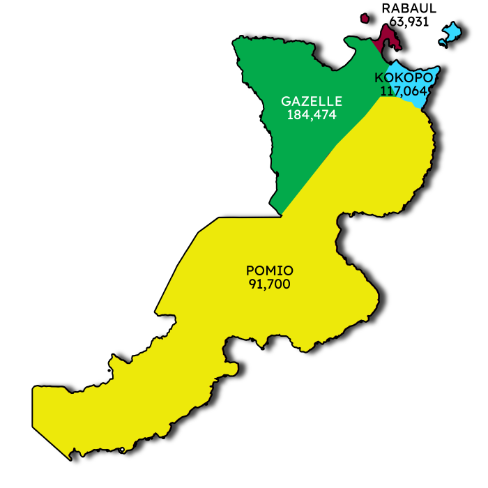
East New Britain is a province situated in Papua New Guinea, encompassing the northeastern part of the New Britain island, along with the Duke of York Islands. Its capital is Kokopo, located not far from the former capital, Rabaul, which suffered significant destruction in a volcanic eruption back in 1994. Covering an extensive land area of 15,816 square kilometers (6,107 sq mi), the province was reported to have a population of 220,133 during the 2000 census, and this number rose to 328,369 during the 2011 count. Additionally, the province’s coastal waters extend over an area of 104,000 square meters (26 acres).
East New Britain shares its only land border with West New Britain Province to the west, and it also has a maritime border with New Ireland Province to the east. The province boasts a mixed economy, where a cash-based system operates alongside the subsistence-farming sector. The cultivation of cocoa and copra stands out as the primary crops produced for export, while tourism has been gaining increasing significance in contributing to the provincial economy.

In Papua New Guinea, each province is composed of one or more districts, and each district consists of one or more Local Level Government (LLG) areas. To facilitate the census process, the LLG areas are further subdivided into wards, and within these wards, there are census units used for enumeration purposes. This hierarchical administrative structure helps in efficiently conducting population counts and gathering essential data during censuses.


The Papua New Guinea’s East New Britain Provincial Government budget for this year is projected at over K600 million.This is the biggest money plan yet

K618 Million Budget Approved by East New Britain Provincial Government for 2023 Under the Leadership of Governor Marum The East New Britain Provincial government’s record-breaking