EAST NEW BRITAIN PROVINCIAL GOVERNMENT

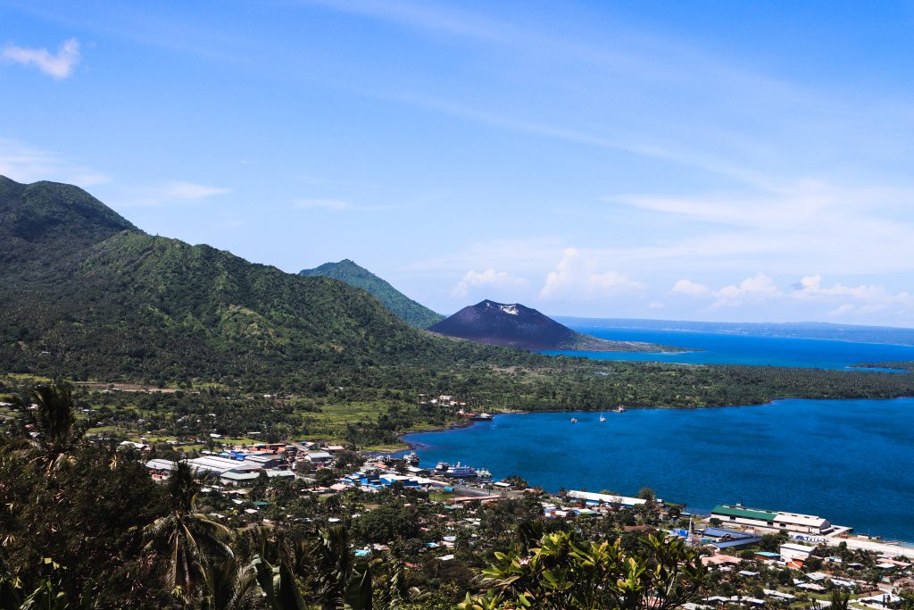
Rabaul
Rabaul District, situated in the northeastern region of East New Britain Province, Papua New Guinea, stands as one of the four distinctive districts within the province, alongside Gazelle, Kokopo, and Pomio Districts. East New Britain Province, one of Papua New Guinea’s 20 provinces, has a rich history dating back to its earliest interactions with the outside world in the late 1700s.
In 1994, a dramatic event unfolded as Mt Tavurvur and Mt Vulcan erupted in tandem, leading to the displacement of numerous residents from Rabaul District and its neighboring areas. These displaced individuals found new homes in resettlement areas located in Kokopo, Pomio, and Gazelle Districts, which are administratively and politically affiliated with Rabaul District.
The administrative structure of Rabaul District, established in accordance with the reforms outlined in the Organic Laws on Provincial and Local Level Government in 1995, comprises four Local Level Governments (LLGs): Rabaul Urban, Balanataman, Kombiu, and Watom Island LLGs. Within the district’s boundaries, you’ll find a total of 52 villages or wards.
The aftermath of the 1994 volcanic eruptions prompted the Provincial Government to secure five resettlement areas – Gelagela, Warena, Clifton, Ah Sing, Vunakabi, and Sikut Resettlement Estates – to provide shelter and services to the affected villages. Presently, Rabaul District plays a pivotal role in delivering essential services to these areas. Notably, about 35% of the district’s population resides in three different districts, while the remaining 75% still call their original villages home.
Regrettably, the 1994 disaster wreaked havoc on the district’s infrastructure and services. Although the Provincial Government initiated restoration efforts, these were persistently hampered by recurring ashfall and periodic mudflows. Consequently, all services were relocated to Kokopo Town, and educational and healthcare facilities were shifted to the resettlement areas.
There remains an urgent need to restore basic services to the original villages, including access to clean drinking water, extensive rehabilitation of education infrastructure affected by continuous ashfall, and significant road improvements. Moreover, several resettlement areas continue to grapple with inadequacies in education and healthcare facilities, compounded by poor accessibility due to deficient road infrastructure. The government’s cluster homes, developed as part of the restoration program, have not fostered social harmony, and social issues have arisen in these densely populated resettlements.
The local economy of Rabaul District suffered a sharp decline during the 1994 volcanic disaster and currently remains at its lowest ebb. The Human Development Report in 1996 revealed that the average household income per annum stood at K833.00. A district-level assessment indicates that this crucial human development indicator has either stagnated or worsened. The emergence of the Cocoa Pod Borer (CPB) and the adverse effects of continuous ashfall on cash crop agriculture have exacerbated the existing challenges, prompting our JDP&BPC to recently designate original villages in our three rural LLGs as destitute areas. The district is fully cognizant of this development disparity and is actively formulating strategies to rejuvenate its economic prospects.